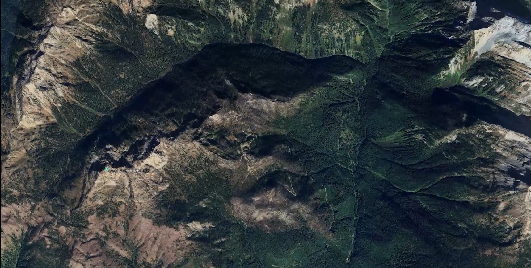
Mountain terrain surrounding the Thor Project in southeastern British Columbia

The Thor Project · Southeastern British Columbia

A premium polymetallic foundation. District-scale opportunity.

A 100%-owned precious- and base-metals project in the historic Silver Cup Mining District, advanced through more than 250 modern drill holes and science-driven exploration.

Ownership
100%
Defined strike
2.8 km
Modern drilling
250+
Explore the project

Project overview

An established resource within a larger mineral system

Taranis consolidated five past-producing mines and used modern drilling to define a continuous, near-surface polymetallic deposit over a 2.8 km strike length. The project is now applying that geological knowledge to the wider Silver Cup Mining District.

Thor hosts documented silver, gold, zinc, lead and copper mineralization, together with occurrences of specialty metals. Its NI 43-101 mineral resource provides the technical foundation; the surrounding district remains an exploration opportunity and is not part of that resource unless expressly stated.

Gloved hands holding mineralized drill core from the Thor Project
Mineralized drill core from Thor. Authentic project photography supplied by Taranis.
01

100% owned

Consolidated ownership across the core Thor asset and wider district land package.

02

Resource foundation

An April 2024 NI 43-101 mineral resource estimate anchors the investment narrative.

03

Brownfield setting

Five historic mines and a century of evidence inform modern target generation.

04

District thesis

A unified 3D model tests targets along a 14 km mineralized system.

Location & access

Southeastern British Columbia, Canada

Thor is situated near Trout Lake and Ferguson within the Revelstoke Mining District and the historic Silver Cup Mining District.

JurisdictionBritish Columbia, Canada
Road accessWinter-plowed regional road to Ferguson; seasonal gravel access beyond
Land tenure27 contiguous Crown Grants cover a significant portion of the known resource

The Crown Grants were originally issued between 1896 and 1914 and are described as fee-simple holdings.

RPA 2013 map locating the Thor Project in southeastern British Columbia Expand map
Regional location map. Source: RPA (2013).

A century reframed

From scattered workings to one modern geological model

The historic record established mineralization. Modern science is testing how the system connects at depth and along strike.
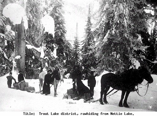
Historic mining photograph supplied with the Thor project materials
Then · 1898–1944

Five high-grade mines

Broadview, Great Northern, True Fissure, Blue Bell and St. Elmo produced 4,931 tonnes of ore containing 1.7 million oz silver, 7.8 thousand oz gold and more than 1.3 million lb of combined base metals.
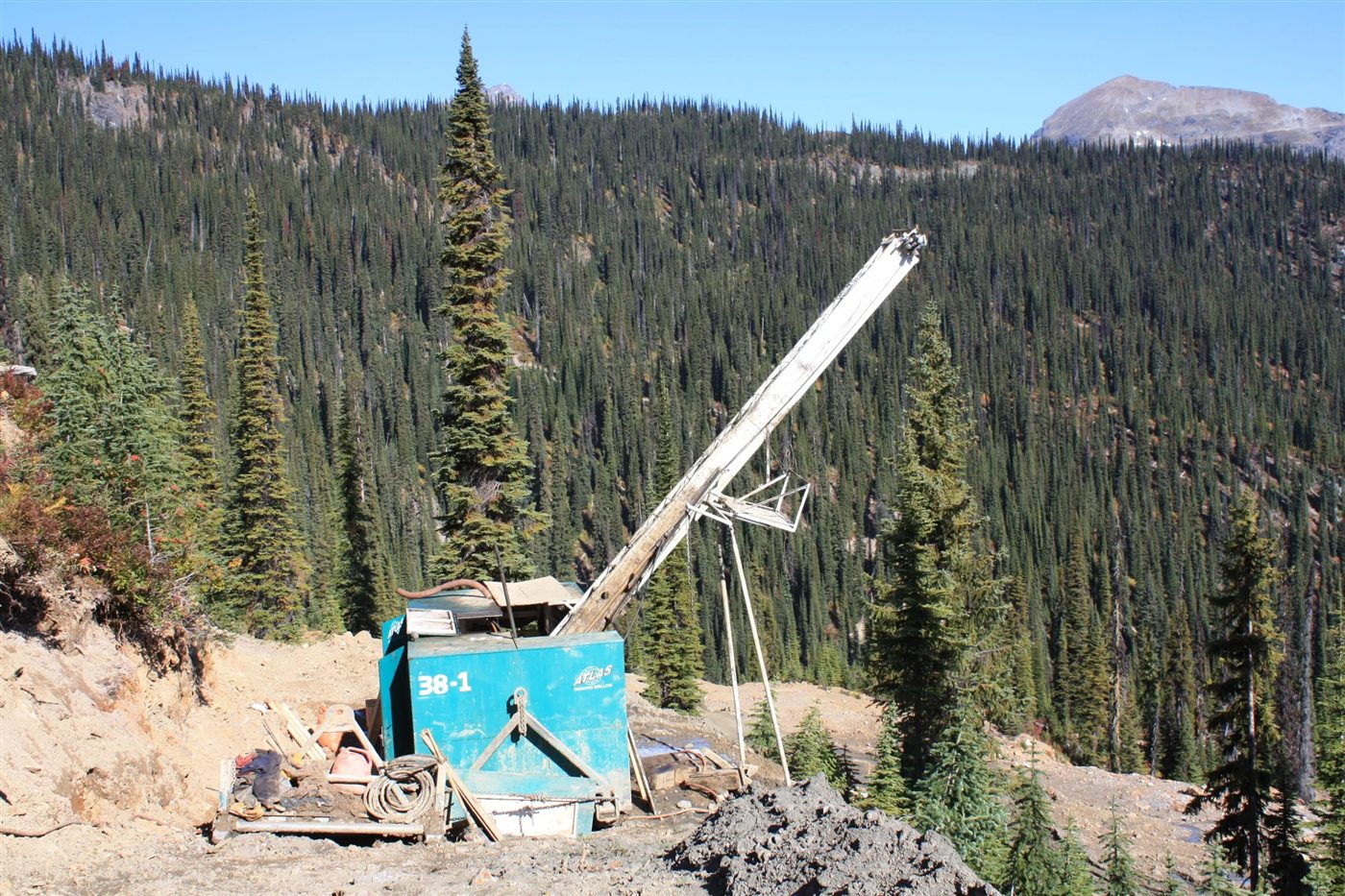
Modern field equipment operating at the Thor Project
Now · science-driven

One connected system

LiDAR terrain mapping, deep-penetrating airborne magnetotellurics and 3D computer inversions support interpretation of a single 2.8 km hydrothermal system.

  1. The Silver Cup Mining District emerges as a high-grade silver-gold camp.

  2. Historic production from the five mines that form Thor's core.

  3. Taranis consolidates the mines and builds a database of more than 250 drill holes.

  4. P&E Mining Consultants completes the updated mineral resource estimate.

NI 43-101 mineral resource

The established foundation

Updated independently by P&E Mining Consultants Inc. in April 2024, with reported increases of 78% in Indicated resources and 41% in Inferred resources over historical estimates.

Thor Project mineral resource — April 2024
CategoryTonnesAg (g/t)Au (g/t)Zn (%)Pb (%)Cu (%)
Indicated1.14 million1520.753.101.900.12
Inferred599,0001170.663.291.580.15

Commodity mix

Illustrative NSR contribution

Silver43%

Zinc23%

Gold18%

Lead12%

Copper4%

Percentages reproduced from the supplied “Thor (Commodity Value by Metal)” chart.

Mineral resources are not mineral reserves and do not have demonstrated economic viability. Inferred mineral resources have a lower level of geological confidence than Indicated mineral resources.

Advancement pathway

From resource definition to process understanding

The supplied project materials identify engineering, flotation metallurgical studies and bulk-sample recovery work as the pathway for generating processing information at scale.

Visit the Mineral Resource page
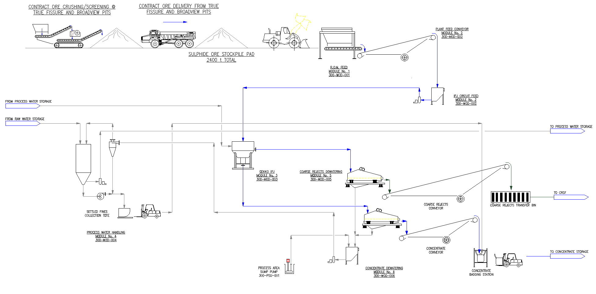
Gekko process-flow schematic for the True Fissure and Broadview material Expand schematic
Gekko process-flow schematic supplied with the project materials.

NI 43-101 mineral resource

The established foundation

Updated independently by P&E Mining Consultants Inc. in April 2024, with reported increases of 78% in Indicated resources and 41% in Inferred resources over historical estimates.

Thor Project mineral resource — April 2024
CategoryTonnesAg (g/t)Au (g/t)Zn (%)Pb (%)Cu (%)
Indicated1.14 million1520.753.101.900.12
Inferred599,0001170.663.291.580.15

Commodity mix

Illustrative NSR contribution

Silver43%

Zinc23%

Gold18%

Lead12%

Copper4%

Percentages reproduced from the supplied “Thor (Commodity Value by Metal)” chart.

Mineral resources are not mineral reserves and do not have demonstrated economic viability. Inferred mineral resources have a lower level of geological confidence than Indicated mineral resources.

Advancement pathway

From resource definition to process understanding

The supplied project materials identify engineering, flotation metallurgical studies and bulk-sample recovery work as the pathway for generating processing information at scale.

Visit the Mineral Resource page
Gekko process-flow schematic for the True Fissure and Broadview material Expand schematic
Gekko process-flow schematic supplied with the project materials.

District-scale opportunity

A consolidated corridor along the Silver Cup Anticline

The known Thor resource is the foundation. The wider land position provides a separate, earlier-stage exploration opportunity along the district's controlling structures.
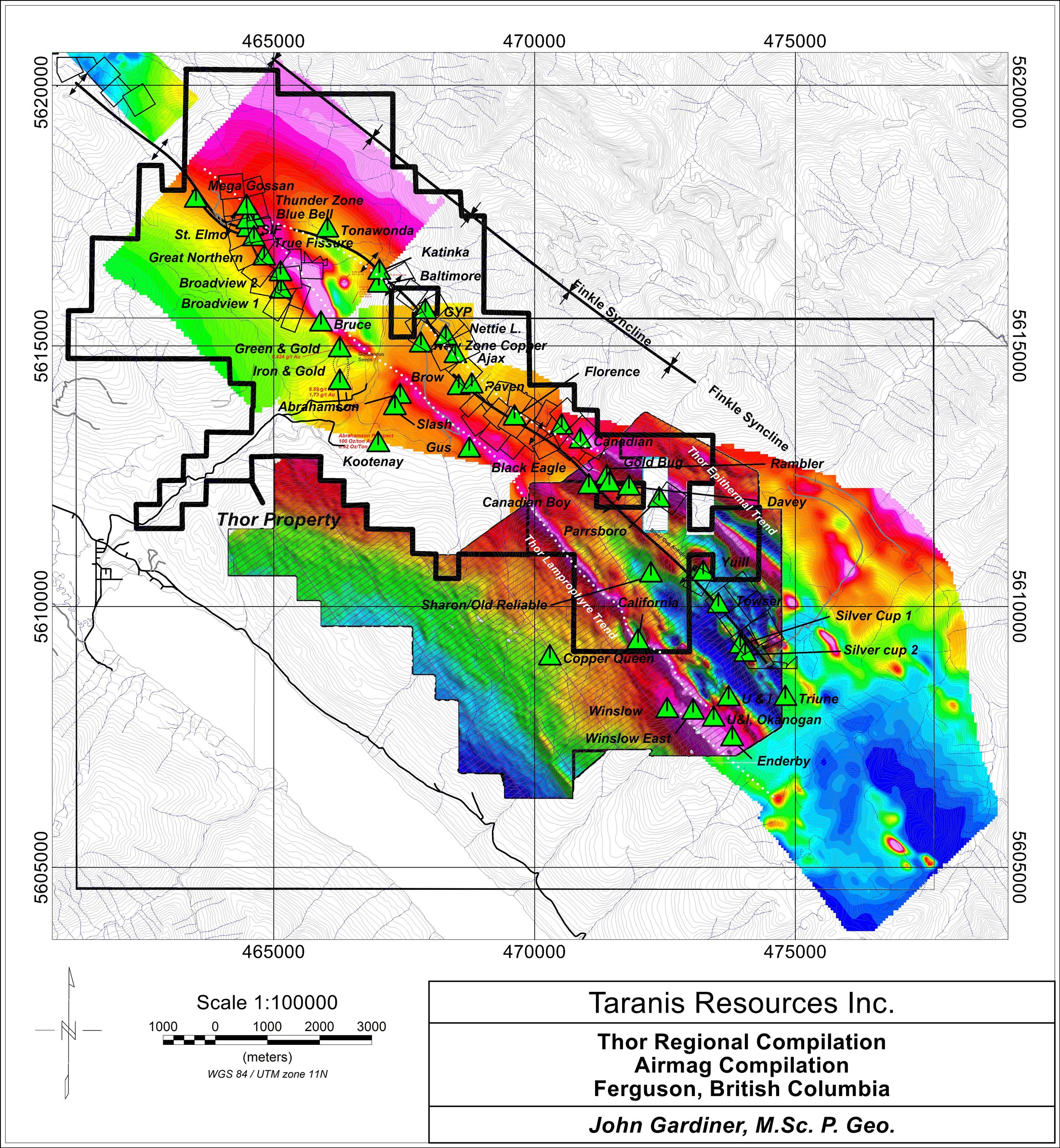
6,400+contiguous hectares
14 kmmineralized system
50+historic mines & prospects
Thor regional airmag compilation showing the property boundary and historic mines and prospects along the district trend Expand district map
Thor Regional Compilation Airmag. Regional prospects shown here are exploration opportunities and are not part of the Thor mineral resource unless expressly stated.
One land position. One district model. A defined resource at Thor and a much broader system to test.

Priority exploration targets

Following the system beyond the known deposit

These are exploration targets, not mineral resources. Target scale and continuity remain to be established through further work.
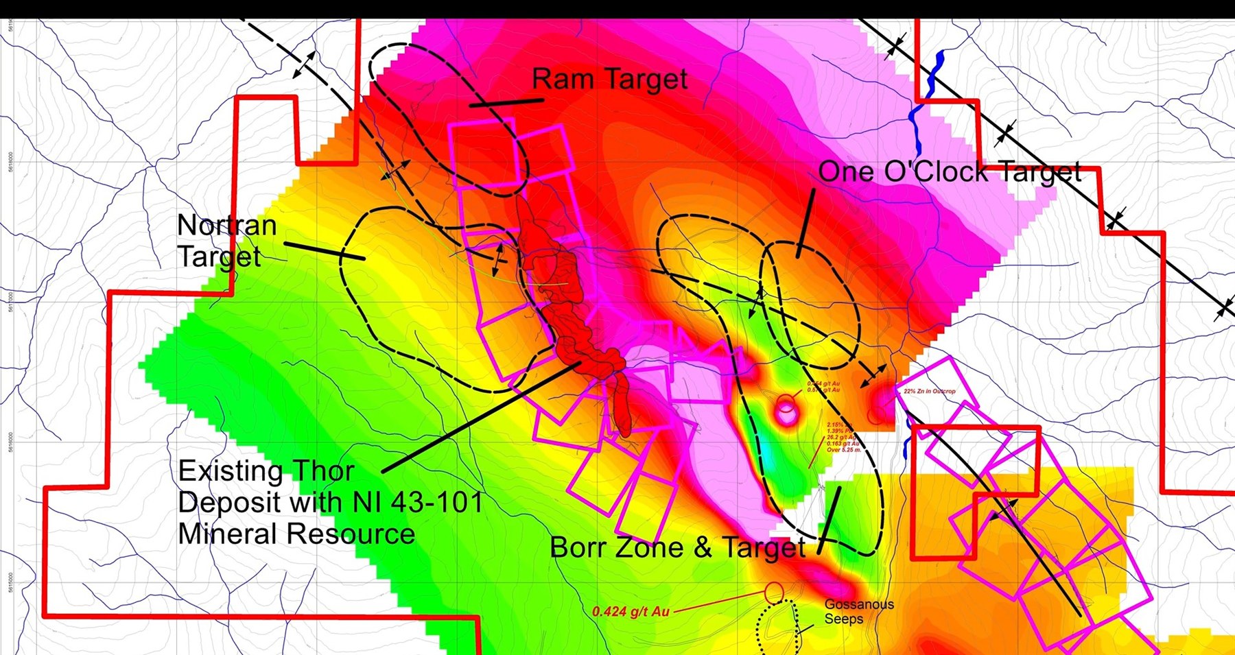
Geophysical map showing the existing Thor deposit and Borr, Nortran, One O'Clock and Ram exploration targets Expand target map
Priority target framework around the known Thor deposit.
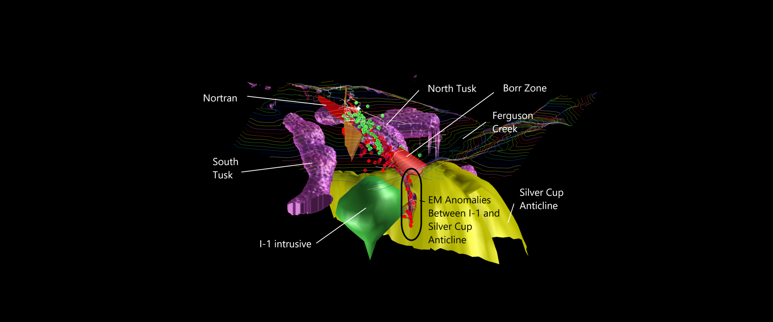
Three-dimensional model showing the Thor deposit, I-1 intrusive, Silver Cup Anticline, Borr and Nortran targets Expand 3D model
3D geological interpretation. Shapes represent interpretations and targets, not mineral resources.
Exploration target 01

Borr Zone

A discovery downslope of the main deposit on the east side of a younger lamprophyre dyke.

Supporting evidence
Thor-256: 5.25 m of 26.2 g/t Ag, 0.766 g/t Au and 3.55% combined Pb+Zn.
Why it matters
If contiguous down-dip, the exploration area could be approximately five times the size of the existing Thor deposit.
Exploration target 02

Nortran · Western Deeps

Interpreted as the fault-displaced western portion of the main Thor system, west of the Ripper Fault.

Supporting evidence
More than 100 mineralized float boulders yielding up to 14.55 g/t Au and 1,705 g/t Ag.
Why it matters
Tests a possible western continuation of the known mineralized system.
Exploration target 03

One O'Clock · I-1

Deep electromagnetic anomalies below 900 m ASL at the contact of the I-1 intrusive and Silver Cup Anticline.

Supporting evidence
A cluster of 3D geophysical anomalies associated with a 1.3 km-diameter intrusive body.
Why it matters
Tests the interpreted deep magmatic source beneath the epithermal system.
Exploration target 04

Ram Target

A northern extension area concealed beneath a rockslide mapped using LiDAR.

Supporting evidence
Historical till sampling at the slide toe returned silver anomalies up to 211 g/t Ag.
Why it matters
Extends the target search up to 2 km north of the Thunder Zone.
Explore the 2026 Exploration Targets

Metals at Thor

A polymetallic system

Metals are grouped by their role in the supplied project materials. Documented occurrence does not, by itself, demonstrate economic recoverability.

Precious

Ag Silver

Au Gold

Base

Zn Zinc

Pb Lead

Cu Copper

Critical & specialty occurrences

Sb Antimony

In Indium

Cd Cadmium

Ga Gallium

Rh Rhodium

Project advancement

A disciplined path from definition to testing

The sequence distinguishes completed technical work from exploration priorities and conditional next steps.

01 · Work completed

Foundation established

  • Five historic mines consolidated
  • More than 250 modern drill holes
  • LiDAR, airborne MT and 3D inversions integrated
  • April 2024 mineral resource update
02 · Current priorities

District target evaluation

  • Test Borr continuity
  • Evaluate the Nortran western extension
  • Refine One O'Clock / I-1 targeting
  • Advance the concealed Ram target
03 · Potential next steps

Generate development data

  • Resource expansion drilling
  • Engineering and flotation studies
  • Bulk-sample recovery work
  • Further economic studies if supported

Future work is subject to financing, permitting, technical results and management approval.

Continue your research

A defined resource. A historic district. A modern exploration thesis.

Review the technical foundation, the priority targets and the latest corporate materials to evaluate the Thor Project in greater detail.