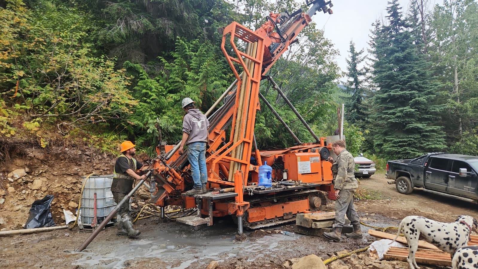
Diamond drill equipment on Great Northern Mountain at the Thor Project

Exploration · Silver Cup Mining District

Precision science.
District-scale discovery.

Taranis is applying more than 15 years of geological, geochemical and geophysical work at Thor to test a wider mineral system across a consolidated district-scale land position.

Land position
6,470 ha
District trend
14 km
Modern drilling
250+ holes

The exploration strategy

Beyond a deposit.
Into the system.

The near-surface Thor deposit provides a detailed geological reference point. The next question is how its structures, alteration and mineralization connect across the wider Silver Cup corridor.

Taranis combines the physical record from drilling with district mapping and deep-penetrating geophysics. Each dataset narrows the search area before a drill tests the interpretation.

Evidence hierarchy

  1. 01
    Known mineralizationCore, assays and historic workings establish the reference.
  2. 02
    System architectureStructure, alteration and geophysics map possible continuations.
  3. 03
    Ranked drill targetsMultiple datasets are integrated before target testing.
5metals documented at Thor
50+historic mines and prospects in the district compilation
1integrated geological framework

The geological model

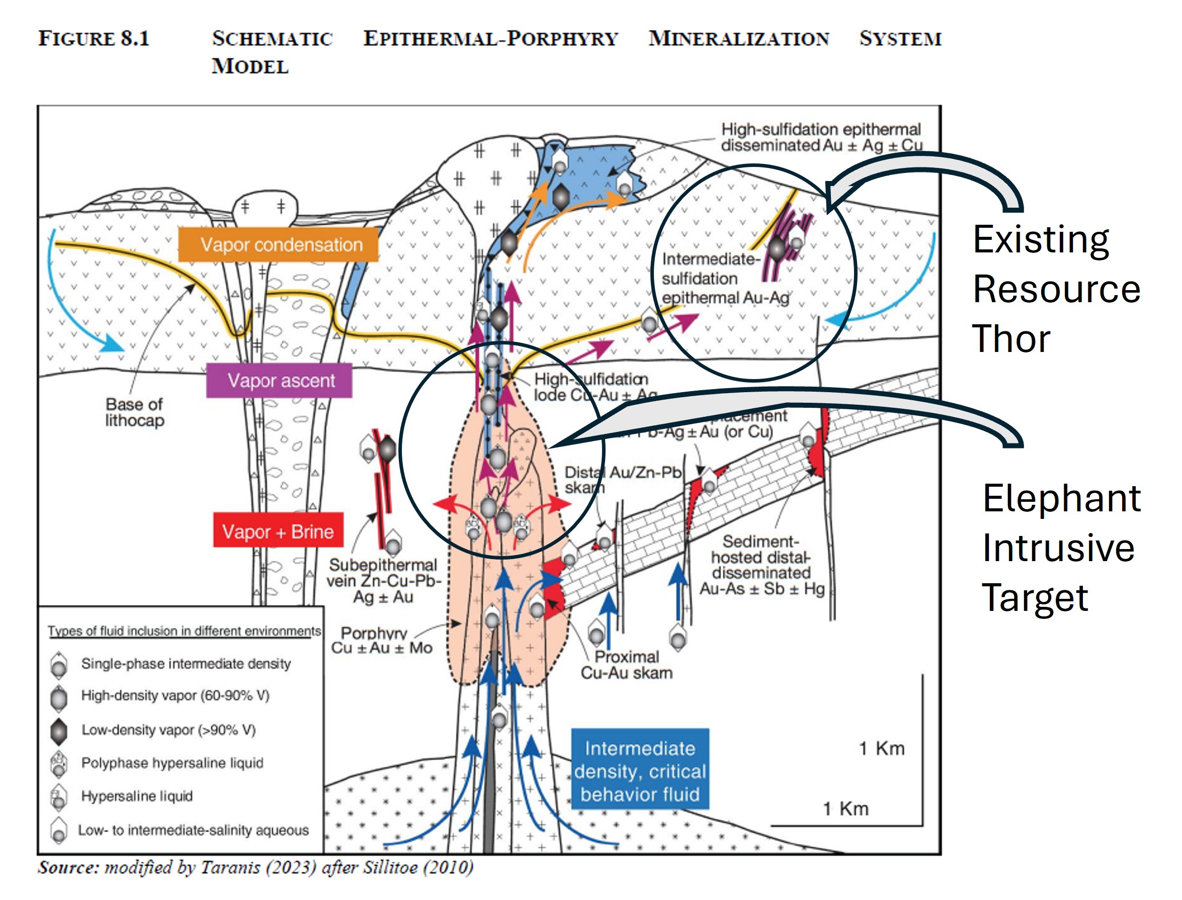
Trunk, tusks & elephant

A plain-language way to separate what drilling has established from what geophysics and alteration suggest may lie deeper in the system.

Schematic epithermal-porphyry mineralization system model Expand schematic
Conceptual system model. Modified by Taranis (2023) after Sillitoe (2010).
Elephant used as a visual metaphor for the larger geological system
Established

The trunk

The drilled, near-surface Thor epithermal deposit and its documented 2.8 km strike.

Supporting evidence

The tusks

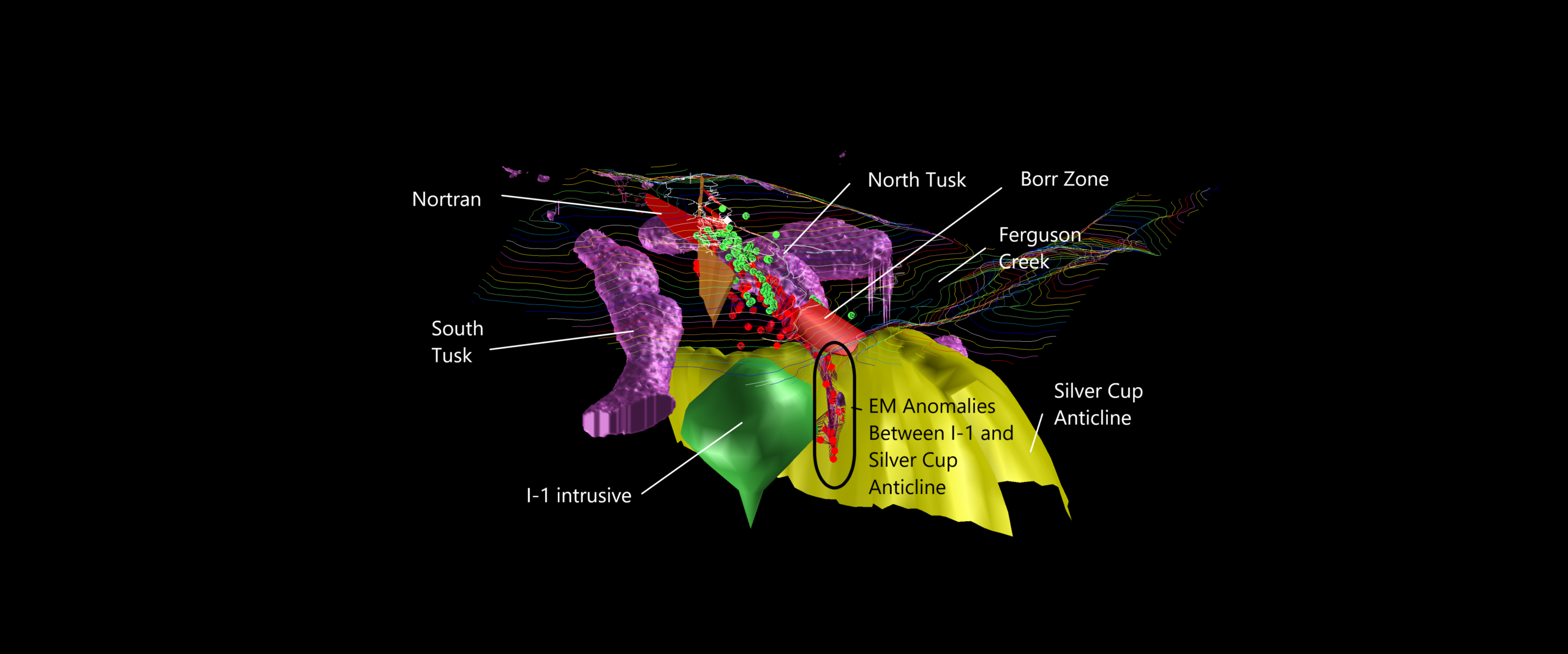
A conductive alteration halo interpreted from geophysics and graphitic material observed in drill core.

Exploration target

The elephant

The deep I-1 resistive feature interpreted as a possible intrusive heat source. It has not been directly intersected by core drilling.

Important distinction

The I-1 feature, its interpreted alteration halo and related deep targets are exploration concepts. They are not mineral resources, and further drilling is required to determine their nature and significance.

Target identification

Seven datasets.
One decision framework.

Each technique observes a different part of the mineral system. The value comes from interpretation across the complete stack.
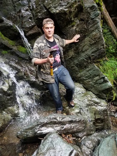
Geologist examining an outcrop during field work
Ground-truthing remains central to the digital workflow.
01 · Physical record

250+ drill holes

More than 19,750 m of modern core provides direct evidence of lithology, metal zonation and structure.

02 · Surface geology

Mapping & alteration

Systematic mapping traces host units and structures along the Silver Cup Anticline.

03 · Terrain

LiDAR

High-resolution elevation data helps identify faults and terrain features beneath dense forest cover.

04 · Geochemistry

Mass balance

Multi-element analysis of 252 core samples evaluates gains and depletions associated with alteration.

05 · Deep imaging

MobileMT

Airborne electromagnetic and magnetic data image electrical contrasts at depth across rugged terrain.

06 · Conductivity

VLF & EM-37

Ground surveys refine conductive anomalies that may correspond with buried structures.

07 · Integration

3D inversion

Geological and geophysical observations are brought into one spatial model for target ranking.

District exploration map

The spatial anatomy of a 14 km trend

Historic workings, modern surveys and the Thor drill database are compiled around the Silver Cup Anticline to show where evidence converges.
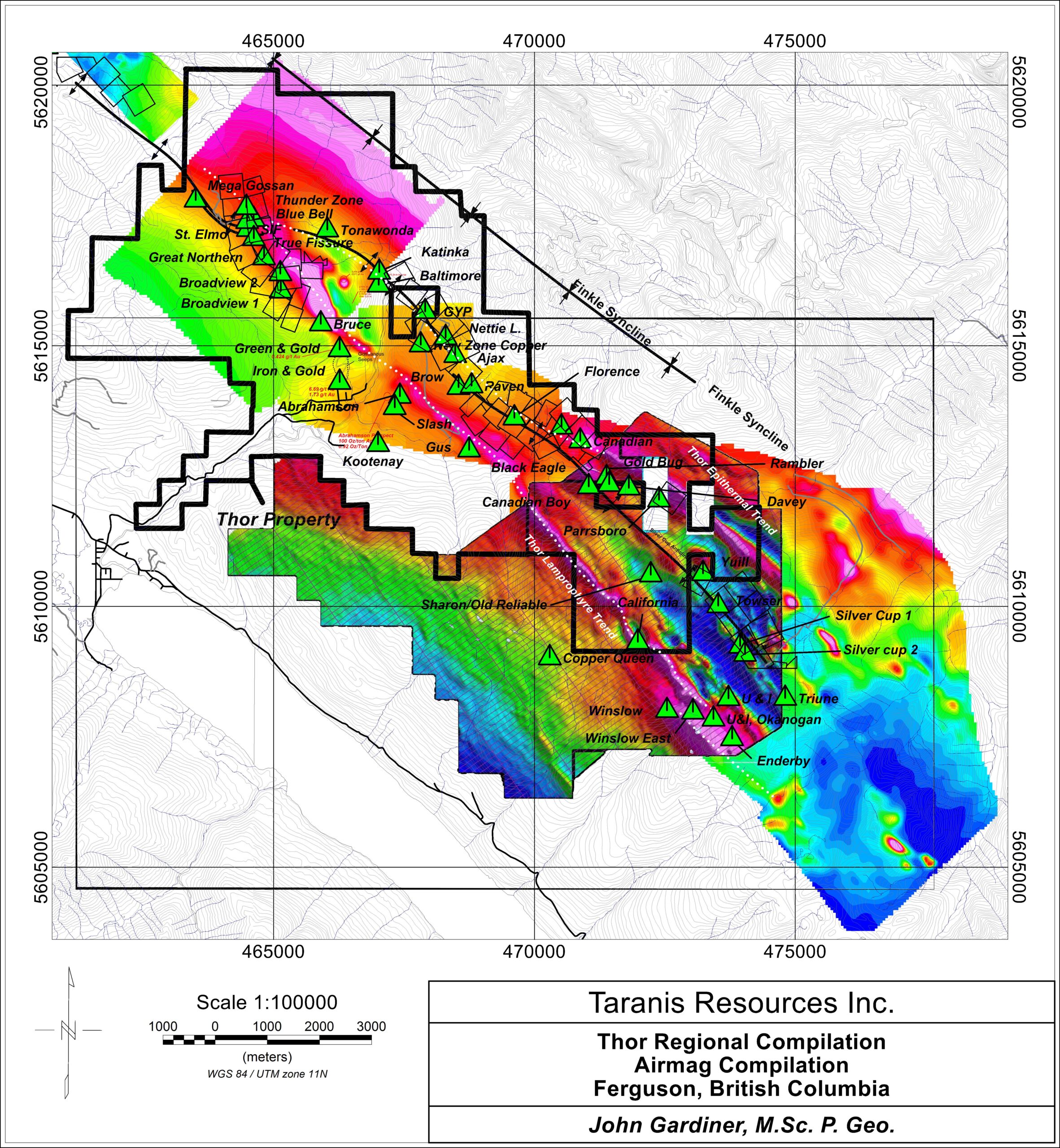
Regional airborne magnetic compilation showing the Thor property and district prospects Expand district map
Regional compilation showing the property position and historic prospects.
Three-dimensional model of Thor, the Silver Cup Anticline and surrounding exploration targets Expand 3D model
Static 3D geological model. An interactive GLB model can replace this image when supplied.

Priority exploration targets

Four ways to test one system

Each target is based on a distinct geological question. None of these target areas is a mineral resource unless expressly stated.
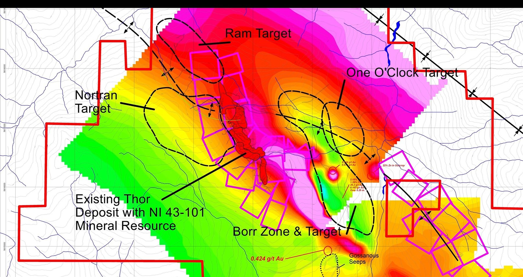
Map showing the Borr, Nortran, One O'Clock and Ram targets around Thor Expand target map
01

Down-dip continuation

Borr Zone

Thor-256, reported October 27, 2025, intersected 5.25 m grading 26.2 g/t Ag, 0.163 g/t Au and 3.55% combined Pb+Zn. Follow-up work is intended to test the geometry and continuity of the zone.

Reference point
1.3 km southeast of Thor
Status
Drill-defined occurrence; continuity under evaluation
LiDAR map showing the Borr target and Ferguson rockslide
02

Western deeps

Nortran

Mineralized float boulders and a cluster of electromagnetic anomalies beneath cover define a search area west of the known Thor trend.

Evidence
Surface float, LiDAR and 19 reported EM anomalies
Question
Can a concealed bedrock source be identified?
03

Deep system connection

One O'Clock

A cluster of deep conductive anomalies occurs near the interpreted contact between the I-1 resistive feature and the Silver Cup Anticline.

Evidence
3D geophysical inversion
Question
What causes the deep conductivity?
04

Northern extension

Ram

Historic datasets and anomalous soil and till results occur near a large landslide north of the Thunder Zone, where bedrock is concealed.

Evidence
Historic data, geochemistry and LiDAR
Question
Does the epithermal trend continue beneath cover?

2026 exploration program

Targets refined as the district model evolves

Current company disclosure identifies Borr and Nortran as the principal near-resource tests, with continuing work on the wider district model and other targets.

Workstream 01

Borr step-out drilling

Test the down-dip continuation along the main access corridor and refine the structural model around the lamprophyre dyke.

Workstream 02

Nortran bedrock targeting

Evaluate priority ground and airborne EM anomalies in the Horton area beneath glacial cover.

Workstream 03

District integration

Bring historic-mine, geochemical and geophysical datasets from the expanded eastern land position into the district model.

  1. Expanded Silver Cup district holdings announced
  2. Borr and Nortran identified as 2026 strategy anchors
  3. Exploration program adjustment announced
  4. Four priority targets outlined across 6,470 ha

This is a disclosure timeline, not a forecast of field dates. Consult the latest 2026 news releases for subsequent changes to scope, access, permitting and timing.

Mineralized drill core from the Thor Project

Built on measured work

A defined resource.
A wider system to test.

The exploration opportunity should be evaluated alongside the April 2024 NI 43-101 mineral resource and the latest technical disclosure.

Mineral resources are not mineral reserves and do not have demonstrated economic viability. Exploration targets are conceptual and require further work.